If you’ve ever done any hiking in New Zealand, or at the very least thought about it, then you would have no doubt heard about the Tongariro Alpine Crossing.
Considered the best day walk in the world, and located in the world heritage-listed Tongariro National Park, the Tongariro Crossing is approximately 19.4 km of sheer outdoor joy across a landscape of dramatic scenery.
And for good reason too.
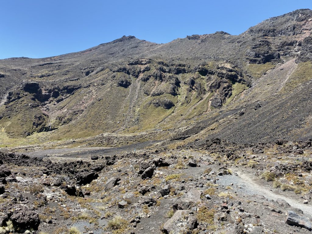
The trail taken through the park is like nothing you’ve ever seen before. From start to finish, it consists of volcanic rock whichever direction you look.
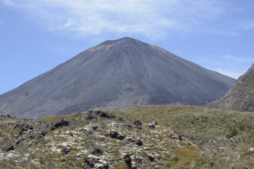
The views of three mountains in the park – Tongariro, Ngauruhoe aka Mount Doom from Lord of the Rings, and Ruapehu – are nothing short of spectacular and really do make you feel small in comparison.
I first completed the Tongariro Alpine Crossing back in early 2016 when three of my friends & I hiked the same trail the Hobbits did in Lord of the Rings walking from Hobbiton (or at least the filming set of Hobbiton) to Mount Doom (Mount Ngauruhoe).
It took us roughly 8 days (1 day off) and 240 kilometres to complete our journey with the Alpine Crossing featuring on the final day.
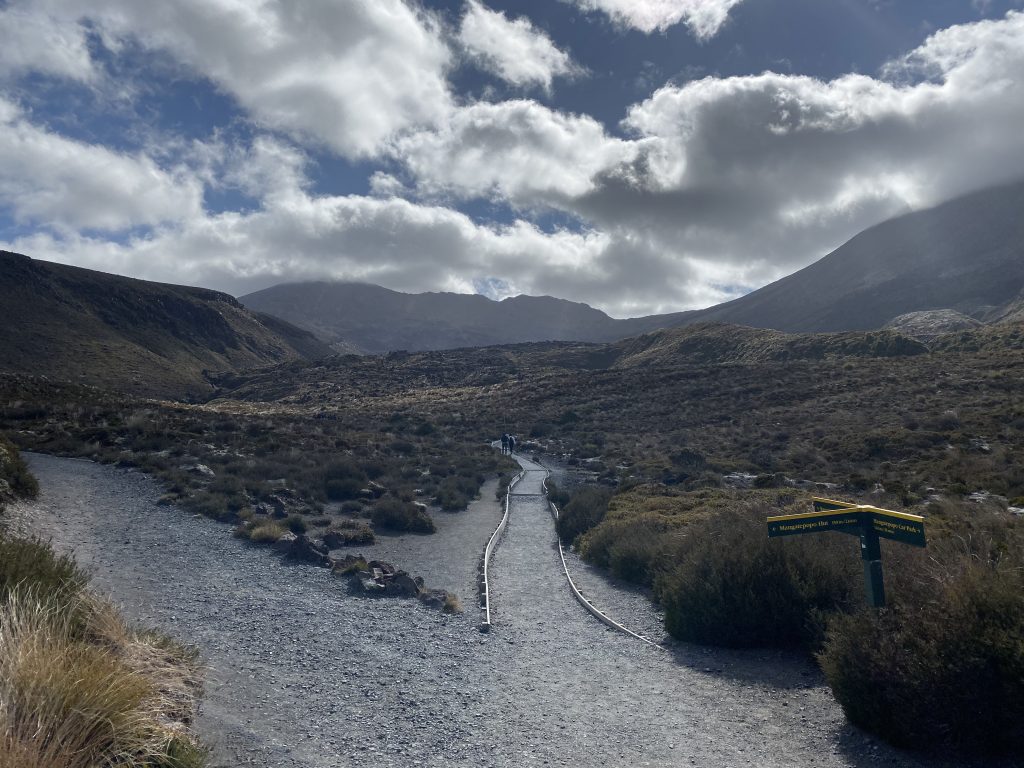
The official start of the Tongariro Alpine Crossing is at the Mangatepopo Car Park at the end of Mangatepopo Road at just over 1,100m in the Tongariro National Park.
It’s worth noting that this is a one-way hike that does require the use of a car shuttle or engaging one of the many Crossing shuttle services in the area.
I’ve no doubt that people have hiked it up and back in one day, but they would be few and far between.
The recommended route is to start at the Mangatepopo Car Park and finish at the Ketetahi Car Park located in the northern section of the park.
Mangatepopo Valley to Soda Springs – 1-1.5 hours
The first section of the Alpine Crossing follows a trail up the Mangatepopo Valley with the Mangatepopo Hut situated 20 minutes in via a side track.
Continuing on a reasonable gradient, the main track climbs alongside a beautiful stream and several old lava flows.
You’ll notice many of these lava flows throughout your walk on the Tongariro Alpine Crossing and make sure to pay particular attention to the different colours of the flows throughout this section.
Soda Springs to South Crater – 1 hour
Once you reach the Soda Springs located at the top of the valley, it begins climbing steadily as you’ll gain 340m in elevation from the Springs to South Crater.
Once you’ve completed this rise in elevation, the track continues east across South Crater and this is where you were able to begin your summit of Mount Ngauruhoe.
However, a few years ago, many signs that were once there educating climbers about what to do / what not to do when summits, are now no longer there as summitting is now discouraged for cultural reasons.
My friends & I were lucky enough to summit back in January 2016, but given the terrain, weather, and general respect for the local iwi, I can understand why summiting is highly discouraged.
If you were caught by a local park ranger trying to summit, then I imagine you’d be escorted back to the start of the trail.
From here onwards, the trail does start to get challenging as you begin to rise further in elevation, and the need to navigate rocky paths becomes more frequent.
It’s in this section that safety signs become more frequent as they educate you on what’s ahead and if you’re not feeling the greatest or weather conditions have taken a turn, then you should turn back.
If this is your first time doing the Tongariro Crossing, then these signs might seem like overkill, but honestly, they could save your life.
Many people have underestimated the conditions or how they’re feeling, and have pushed on which has resulted in them having to be rescued or perishing on the trail.
Pro tip: if you are having any second thoughts about finishing the hike at this point – turn back.
 South Crater to Red Crater – 45 minutes to 1 hour
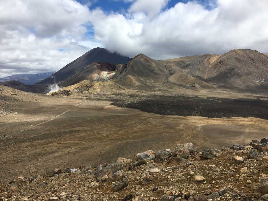
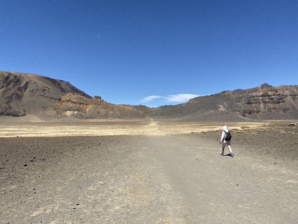
Once you’ve passed South Crater, you’ll find yourself following a poled route over the Crossing and on your way to Red Crater at 1,868m which is approximately the halfway mark and the highest point on the trail.
As you make your way up the ridge to Red Crater you may start to smell sulphur which is evidence that the crater is still very much active.
Furthermore, this area is incredibly exposed and if conditions are windy then it can be quite dangerous.
I attempted the Tongariro Northern Circuit in late 2019 and was unable to complete the first day, as there were 75km winds on the Red Crater which made it incredibly difficult to cross.
Again, if conditions aren’t the greatest, then you should turn back.
From Red Crater, you’ll get amazing views of the Kaimanawa Forest Park, home to the Mount Urchin Walk, and the Desert Road located on the east/southeast side of the Tongariro National Park.
 Red Crater to Ketetahi Car Park – 4-4.5 hours
Once you’ve walked over the Red Crater, you’ll start descending on your way to the end of the Crossing at the Ketetahi Car Park.
It’s worth noting that to make it back to your shuttle service on time (assuming you’ve engaged with one), you’ll need to ensure that you’ve left Red Crater no later than 12:30pm.
Be sure to watch your footing as you descend the volcanic scree as it can be loose and unstable in several sections.
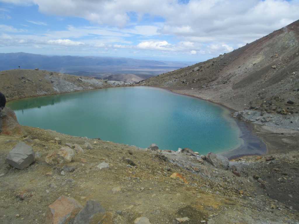
The next highlight that you’ll come across on the Tongariro Alpine Crossing is the Emerald Lake which, as the name suggests, is an emerald-coloured lake that is simply stunning.
Please note, that you can’t swim in this lake or any of the lakes featured on the trail.
From Center Crater, which is also home to Blue Lakes, you will follow the Rotopaunga Valley down to the Ketetahi Hut.
There are restrooms available to you at this hut, but be prepared to line up for a period of time during times when there are many people walking the Crossing i.e. October to April.
From here, it’s only another 2 hours of relatively easy terrain as you make your way to the Ketetahi Car Park and your shuttle to take you back to your accommodation ending your Tongariro Alpine Crossing adventure.
Frequently Asked Questions
How long is the Tongariro Alpine Crossing
It’s 19.4 km in distance and can take 6-7 hours to complete.
How hard is the hike?
Despite its popularity, the Tongariro Alpine Crossing is a challenging yet rewarding day hike. If you’ve never hiked before, you’re going to find it really tough. But if you have a good level of fitness, you’ll be able to complete it without any real issues.
Either way, come prepared for a day full of rewarding adventures on the trail.
How to get to the Tongariro Alpine Crossing?
The walk itself is located in the Tongariro National Park and starts at the Mangatepopo Car Park. You will need to organise a car shuffle or shuttle service in the area as parking your car at the start is no longer allowed due to rampant theft.
The trail ends at the Ketetahi Car Park on Ketetahi Road.
How much food & water should I take?
You’ll be out on the trail for a full day, so we’d encourage you to take several snacks and lunch, as well as at least 2-3 litres of water. There are no places on the trail to source water from.
What type of gear should I bring?
This is a really important question. You should pack warm & cold weather gear such as jackets, pants, gloves, a hat, gloves, etc. as the weather can turn in an instant. A sturdy pair of shoes is strongly recommended for this walk.
Our friends over Walking Legends, who are local operators to the Crossing, have put together a handy guide on what to bring when you’re walking the Tongariro Crossing.
Do I need to book the Tongariro Crossing?
At the time of publishing this blog, you don’t need to book to walk the Tongariro Crossing. However, there is some talk that daily numbers on the trail might be capped which may force you to book your spot.
If you are looking to engage one of the local shuttle services to drop you off at the start and pick you up at the end, you will need to book in advance.
There are a number of them available around the park and surrounding areas such as Taumaranui, Taupo, Turangi, and more.
What’s the best time of year to hike the trail?
Another common question about the Crossing. Typically, November through to April is the best time to hike the Tongariro Alpine Crossing simply due to the weather & overall conditions.
