If you’ve ever been to New Zealand before for a holiday that’s involved a bit of hiking, or perhaps for purely hiking reasons only, there’s every chance you’ve heard of the Tongariro National Park.
Located in the middle of the North Island, and a popular skiing destination in the winter, the Tongariro National Park is home to what many consider to be the best day hike in the world – the Tongariro Alpine Crossing.
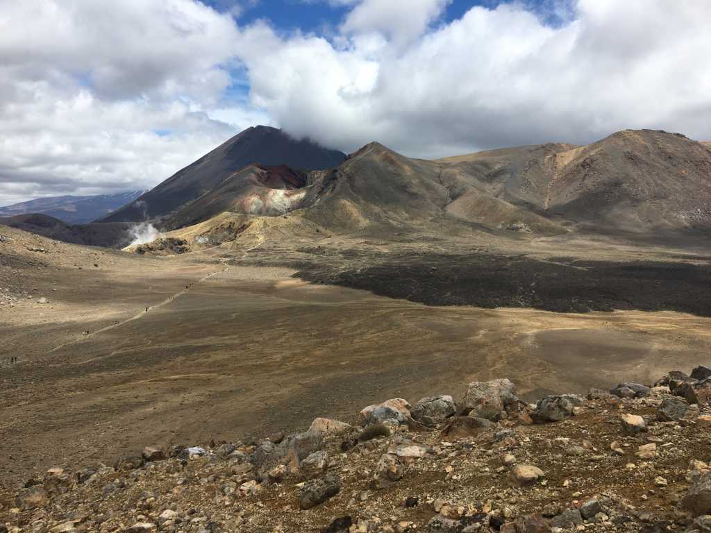
This is just over 19 kilometres of some of the best scenery you could ever imagine on a day hike as you make your way over volcanic rock and skirt around the base of Mount Ngauruhoe aka Mount Doom from Lord of the Rings.
But, did you know there are many other walks in the Tongariro National Park that are just as interesting and scenic as the Alpine Crossing?
They might not be nearly as popular as this infamous walk that draws people from all around the world, but they are certainly worth doing if you’re ever in the area.
As always at The Hiking Society, we only ever publish hikes and walks that we’ve done so we can accurately and appropriately answer your questions about them should you have any.
With that in mind, and given there are so many hikes and walks in Tongariro that we’ve yet to do, this will be updated as we complete each walk.
Tongariro Alpine Crossing
Lets get the most popular walk out of the way first, shall we?
Drawing approximately 1,000 walkers/hikers/trampers/bushwalkers to it daily during the warmer months of the year, the Tongariro Alpine Crossing is without a doubt the most popular day hike in New Zealand and the world.
Before Peter Jackson used parts of the area as Tolkien’s Mount Doom in his film adaptation of Lord of the Rings during 2001-2003, it was still a popular hike.
But it has obviously become somewhat more popular due to the release of the films, as walkers of various experiences from around the world flock to the volcanic, rocky paths that the fictional Hobbits Frodo & Sam trudged up to save Middle Earth.
Starting from the Mangatepopo car park at around 1200m, this is a one-way hike that involves a car shuttle either through your own means or through one of the many transport operators in the area.
From start to finish, you are surrounded by absolutely stunning landscapes to the point that even though it might take you 8 hours to complete, it’ll be more like 9-10 hours given the stops you’ll make to take photos.
From the car park to the highest point on the trail – Red Crater at 1900m – you’ll slowly grind your way along the path and make your way across the actual Tongariro Crossing at 1700m.
This is a largely flat section of volcanic rock and scree where you’d be forgiven for thinking you were visiting Mars.
Once you make your way up and over Red Crater, it’s mostly downhill from there with various highlights along the way including the stunning Emerald Lakes and views across the northern sections of the park.
Learn more about the Tongariro Alpine Crossing by reading our blog on this famous walk.
Mount Ruapehu Walking Track
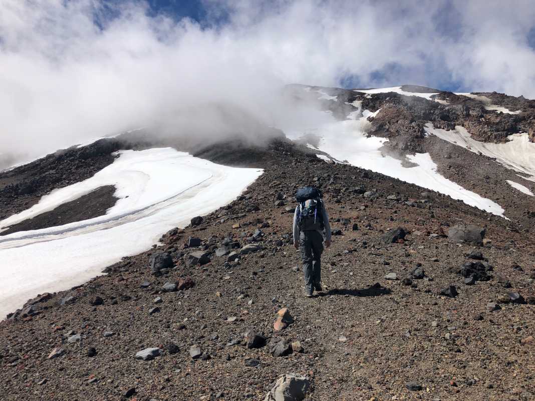
If you don’t enjoy crowds but would still like similar scenery to that of the Tongariro Alpine Crossing, then the Mount Ruapehu Walking Track is for you.
If I’m completely honest, I got far more enjoyment and a heightened sense of adventure when I completed this walk than perhaps I did on the Crossing.
The Crossing is an absolutely stunning walk, but there’s something absolutely rewarding about completing the challenging Mount Ruapehu Walking Track.
A return track on the volcanic slopes of the nearly 2,800 metre mountain in the south-eastern regions of the Tongariro National Park, the track begins on the Whakapapa Ski Fields at the end of Bruce Rd located at the back of Whakapapa Village.
Approximately eight kilometres in distance, there’s an option to summit the mountain but I must stress that I would only attempt this if you are a) an experienced hiker who has b) dealt with alpine conditions before.
Trust me when I say that conditions up there can turn in an instant, and if you aren’t prepared for it then life can become very frantic very quickly.
Unfortunately, back in the summer of 2017/2018, my friends and I fell an agonisingly 200m short of summiting due to a thick section of ice that we couldn’t cross simply due to lack of gear.
In saying that, it doesn’t make the walk any less enjoyable.
As you slowly make your way to the top (or close to it), the scenery around and below you is simply stunning.
You’ll see Mount Ngauruhoe & Mount Tongariro off in the distance, Mount Taranaki in the nearby Egmont National Park, and the Tongariro Forest as you look back at how far you’ve come.
I could keep going on about it, but you’re just going to have to read about this hike here that I – and I know this is incredibly controversial – rate every so slightly higher than the Tongariro Alpine Crossing.
Tawhai Falls Walk
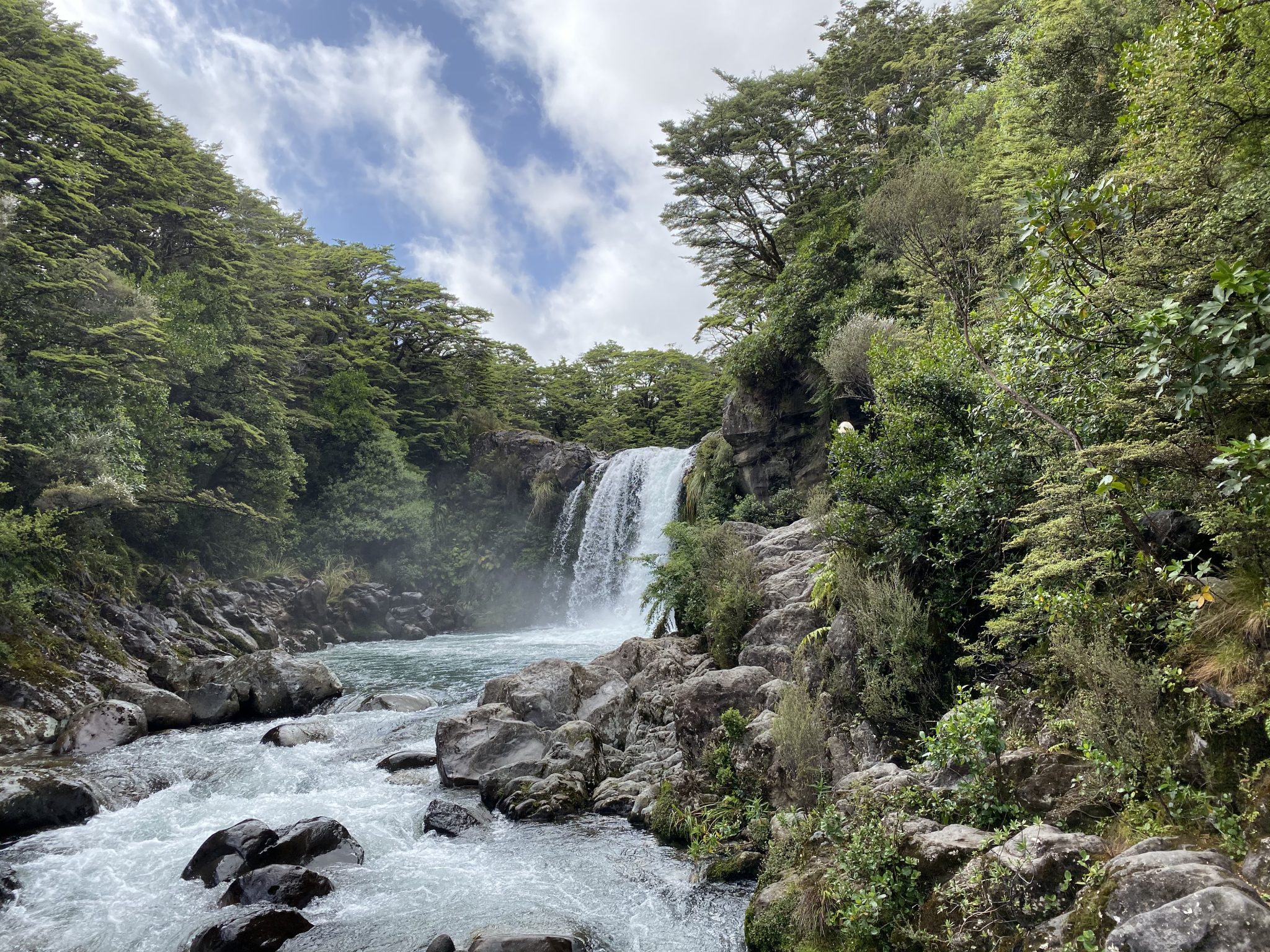
From the challenging slopes of the Mount Ruapehu Walking Track, I thought it might be worth featuring a much gentler walk – the Tawhai Falls Walk.
Again, if you are a fan of Lord of the Rings, you might recognise the Tawhai Falls Walk (pronounced Taw-fai) as Gollums Pool in the second film of the trilogy – the Two Towers.
An incredibly easy walk that starts from an accessible car park on the side of the main road heading into Whakapapa Village, anyone with a base level of fitness will be able to complete this “walk”.
At approximately 1.5kms, most hikers/trampers/bushwalkers could easily do this walk but that’s really not the point.
It’s very much a wandering the paths and sitting by the river type of walk which is incredibly relaxing. If you love outdoor photography, then you’re going to get plenty of enjoyment from the vantage points of the waterfall here.
It doesn’t matter if you’re a casual walker, looking for an outdoor experience without a modicum of a challenge, parents with kids, or if you’re nearby and short on time, the Tawhai Falls Walk is easily the most accessible walk in the Tongariro National Park.
Whakapapanui Track
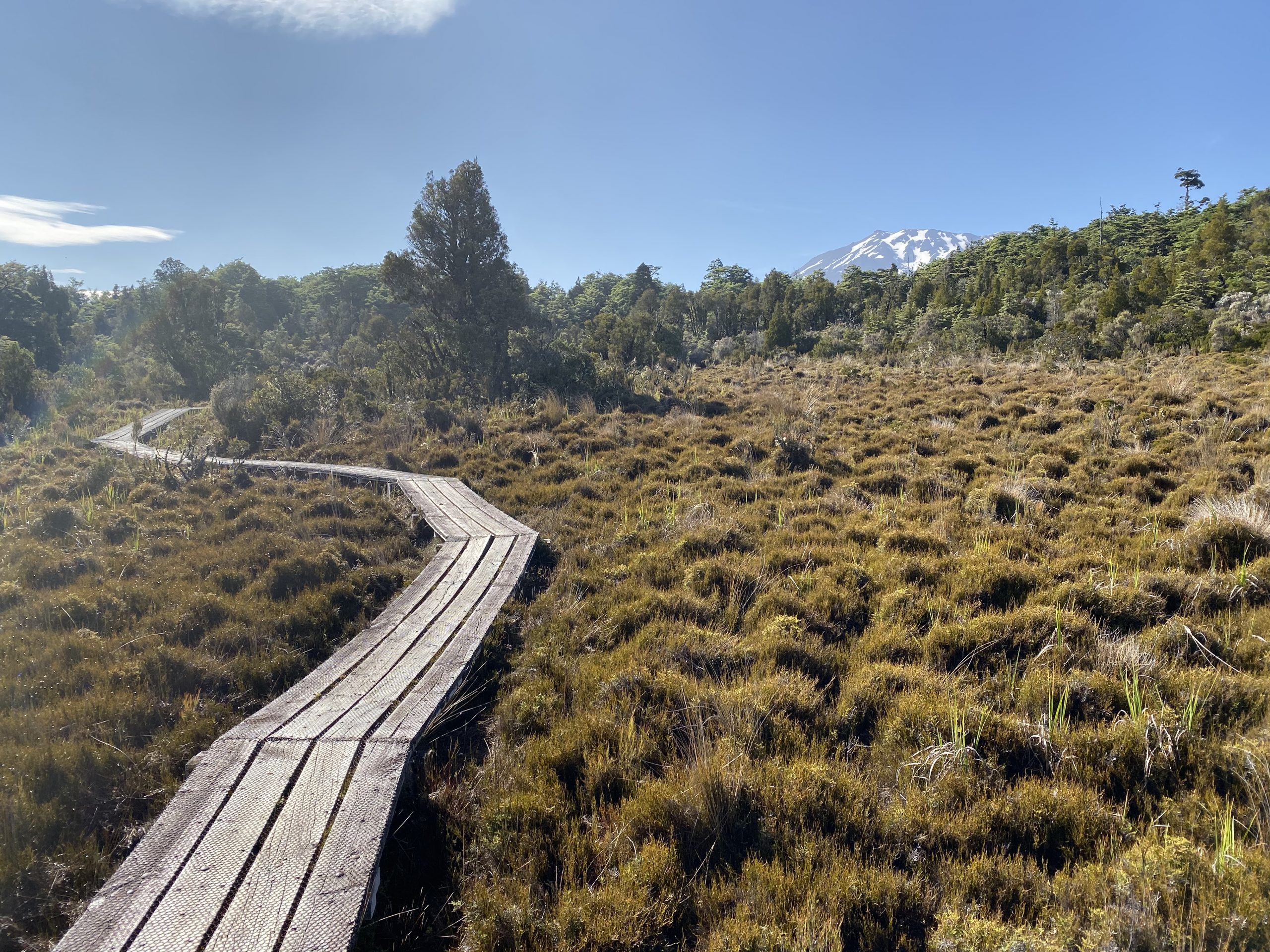
A relatively easy, grade 3 return hike starting on the edge of the Whakapapa Village, the Whakapapanui Track is 7kms in distance and should take approximately 1.5-2.5 hours to complete.
I think what I really enjoyed about this walk is that you spend the majority of your time under the shade of the forest, and you get some really nice views of Mount Ruapehu.
Along with the previously mentioned Tawhai Falls Walk, the Whakapapanui Track is possibly the easiest hike you can do in the Tongariro National Park.
This is yet another hike in the area that regardless of your outdoor experience, you can easily complete this hike without much issue.
If you’re staying anywhere in the nearby Whakapapa Village or National Park Village, then we can’t recommend this enough as a short walk that will leave you wanting more.
Tama Lakes Walk
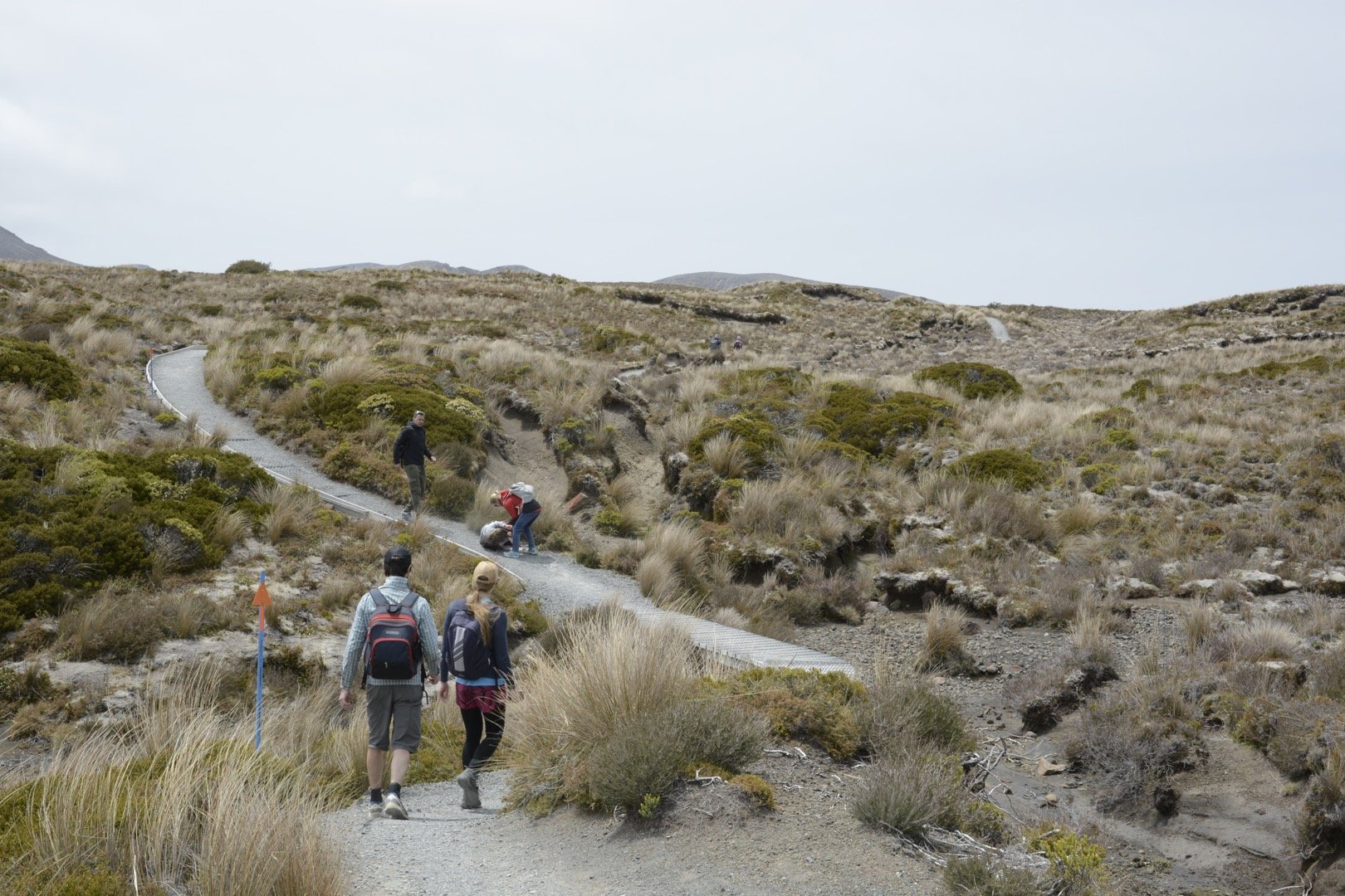
If you’re looking for another alternative to the Tongariro Alpine Crossing, the Tama Lakes Walk is a great challenge for experienced hikers who aren’t afraid of heights.
Similar to a lot of the hikes & walks in the Tongariro National Park, the Tama Lakes Walk begins at the Whakapapa Village right near the entrance of the Skotel Alpine Resort (a convenient location if you’re staying here!)
A solid return day hike at approximately 16.5kms, it forms part of the popular 3-4 day Tongariro Northern Circuit; which is one of New Zealand’s Great Walks.
For the most part, the walk follows a rocky path through exposed, hilly sections of alpine herb fields and tussock, and the occasional boardwalk.
But certainly, the real adventure experience of the walk is when you come to the lake that features both upper and lower tracks respectively known as Upper Tama Lakes & Lower Tama Lakes.
Skirting around the ridge overlooking the lake is really something else, but to do so safely requires reasonably good weather as the wind can really take hold of you here and create quite the nervous experience.
As compensation for this, and assuming you’re walking Tama Lakes on a clear day, you’ll get stunning views of Mount Ruapehu off in the distance.
Again, if you really want to avoid the crowds of some of the more popular hikes in the Tongariro National Park, then the Tama Lakes Walk is certainly for you.
Waitonga Falls Track
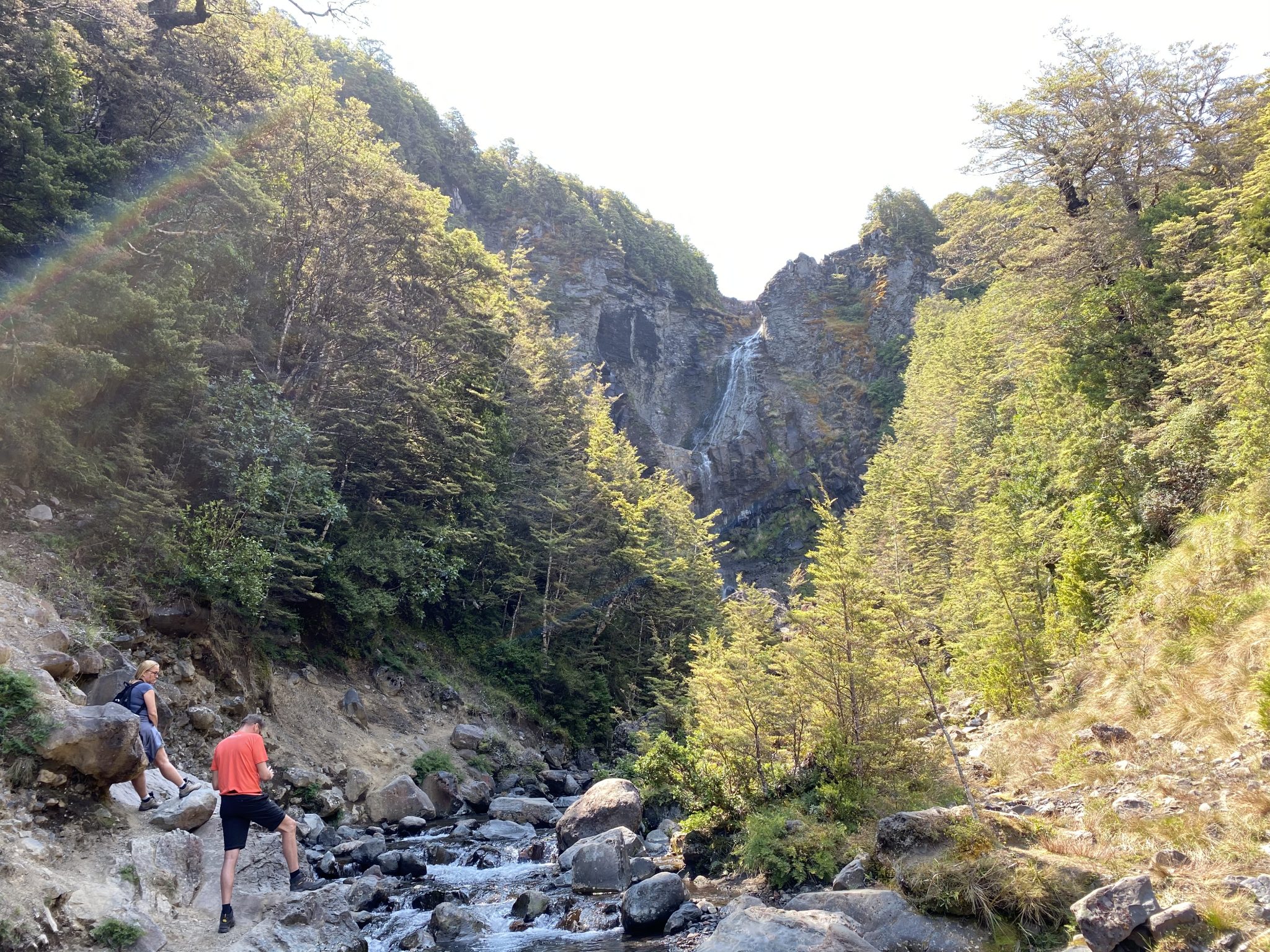
A walk that I think doesn’t get enough attention in the Tongariro National Park is the Waitonga Falls Track.
Located on the southern end of the park near Mount Ruapehu, and the alpine town of Ohakune, there are two versions of this hike but for the purpose of this guide, we’ll focus on the 13.5km version.
Starting at a car park on the Ohakune Mountain Road on the Old Blyth Track (which forms part of the Round the Mount Track), the first section is certainly a slow & steady rise through mountain beech and mountain cedar forest.
This is especially handy as it will provide you with plenty of shade if you are hiking this track on a hot day (as I was when I completed the hike).
Eventually popping out into open areas with views of Mount Ruapehu, you’ll find yourself wandering across a boardwalk and then back into more forest sections as you descend into the waterfall area itself.
Whilst the Waitonga Falls itself isn’t accessible, you’re still able to scramble across many rocks and feel the cold water coming from the waterfall further downstream.
A short drive from the Whakapapa Village, the Waitonga Falls Track is certainly a hidden gem in the Tongariro National Park that can be completed by those with a good level of fitness.
There are very hurdles to overcome, however, the first section of the longer version can be a bit of a grind but if you take your time, you should be able to complete this section without issue.
Taranaki Falls Walk
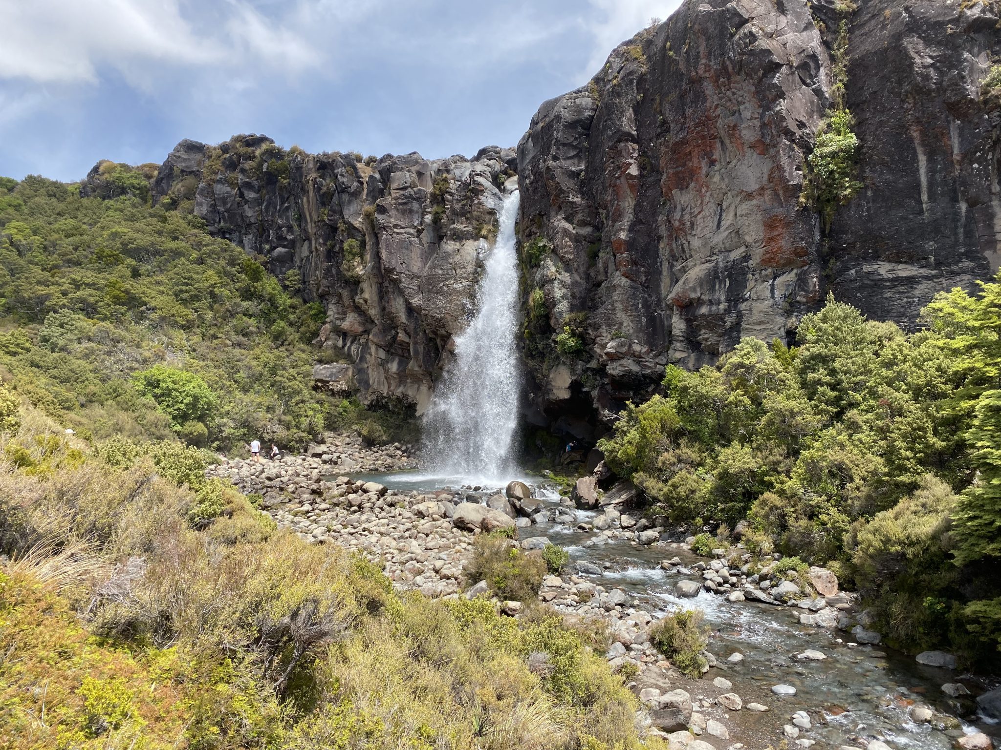
Another hike that starts and finishes near the entrance of the Skotel Alpine Resort, the Taranaki Falls Walk is simply brilliant.
Just shy of 6.5kms, it’s easily one of the most popular loop hikes in the Tongariro National Park as it appeals to both experienced and casual walkers.
Inclusive of stops to take several thousand photos of the area, and the waterfall itself, it should take you approximately 2-2.5 hours to complete.
But if you happen to walk this track on a good day’s weather, then you could be out there for longer.
With two viewing platforms of the Taranaki Falls itself, with many opting for the one at the base of the waterfall rather than at the top, it certainly gives you a glimpse into what might be to come if you have your eye on some of the more advanced walks in the park.
I completed the walk in an anti-clockwise direction which I think is the best way to do it, as you start off with some really stunning scenery, visit the waterfall at about the halfway mark, and then finish off wandering through some dense mountain beech forest before arriving back at the Skotel Alpine Resort.
Regardless if you’re an experienced hiker or someone who likes a walk on the odd occasion, the Taranaki Falls Walk is super accessible and can be easily completed.
Mangatepopo Track
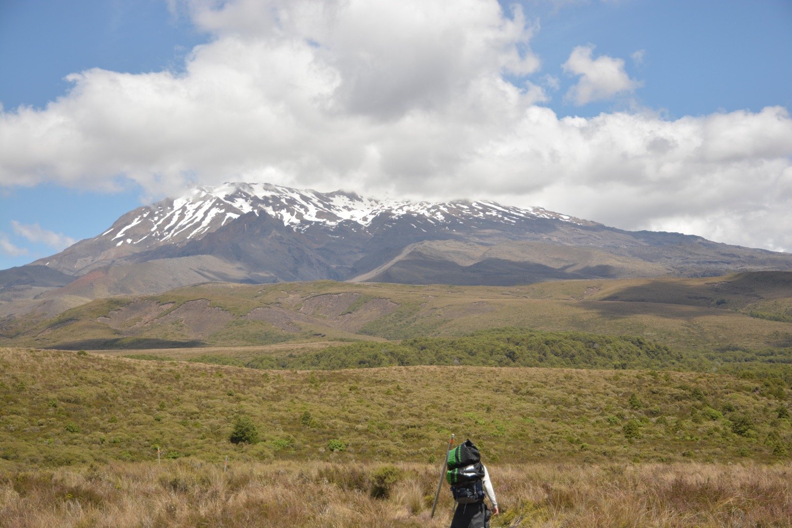
A walk that probably doesn’t feature as a standalone walk on many outdoor blogs, the Mangatepopo Track is a walk that I think everyone should do at least once when staying in the Tongariro National Park.
I have decided to include this relatively straightforward track in this adventure guide for a variety of reasons:
- It gives you a glimpse of what you’re in for should you want to hike the Tongariro Alpine Crossing or Tongariro Northern Circuit
- It can be done as a day hike or an overnight hike as there’s a bookable 20-bunk hut – the Mangatepopo Hut – located at the start of the Tongariro Alpine Crossing where you can stay inside or pitch a tent outside
Once again starting at the Skotel Alpine Resort in the Whakapapa Village, the Mangatepopo Track branches off from the Taranaki Falls Track and forms part of the Tongariro Northern Circuit.
Approximately 7.5kms one way, and starting at just shy of 1,100m in elevation, you will find yourself rising and falling on the path as you make your way to the hut at approximately 1,182m.
The beauty of this walk is that 90% of it is in a completely open area and Mount Ngauruhoe & Mount Ruapehu provides the perfect backdrop for the hike (depending on the direction you’re walking it).
Regardless of whether you plan on doing this as a day hike or an overnight adventure, always ensure you come prepared for all sorts of weather because things can turn quickly at any time of the year.
It’s worth noting that during Great Walks season (October-April) you will need to book yourself in for the hut, but during the off-season (May-October) it works on a “first come, first serve” basis.
There really is nothing quite like a New Zealand backcountry hut, and the Mangatepopo Hut is no exception.
The hut rangers during the Great Walks season are incredibly helpful with regards to weather etc. particularly if you plan on doing the Alpine Crossing or the Northern Circuit.
Hikes Nearby the Tongariro National Park
Despite the fact that this guide is highlighting many of the wonderful hikes in an extremely picturesque part of the New Zealand North Island, there are a number of nearby hikes that we think are worth featuring in this guide too.
The 42 Traverse
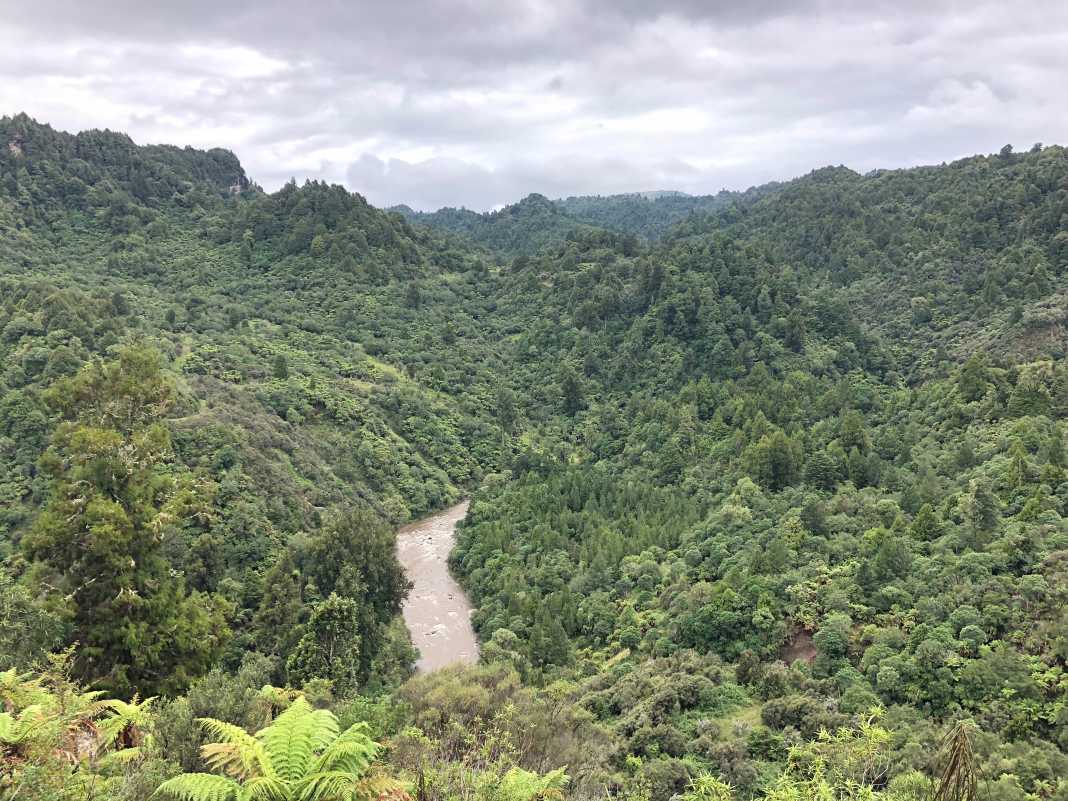
Located in the nearby Tongariro Forest, and a part of the famous Te Araroa trail, the 42 Traverse is a one-way & two-day hike that is an excellent option for those of you who love the quiet on the trail.
Typically inhabited by four-wheel drive vehicles & bikes of various kinds, it makes for a relatively wide path which is not typical of bushland trails.
Ideally started in the town of Owhango at 395m, there is approximately 45 kilometres worth of trail to cover over the two days.
The track itself can be quite challenging in parts and there are a couple of small river crossings, including a larger river crossing, that you’ll come up against.
It’s worth noting that there are no official campsites on the trail. However, there are a number of grassy sections where you could easily pitch 1-2 tents in each section.
There is one particular section at approximately the 25-kilometre mark that is by a stretch of river and could easily hold 5 tents.
There are two endings to the 42 Traverse trail:
- The ending where most mountain bikers & 4×4 vehicles arrive finishes at Kapoors Road car park which is closest to the main two entrances into the Tongariro National Park on the northeast side.
- If you are a Te Araroa hiker, you will finish the walk via the Te Porere Bypass which finishes further up SH47 in the northeast section of the park.
When I hiked the trail, I finished up at Kapoors Road car park and organised a ride to the Mangatepopo Car Park at the start of the Tongariro Alpine Crossing.
If you’re keen on an overnight adventure and want to steer clear of the crowds, then you could do far worse than the 42 Traverse.
Mount Urchin Track
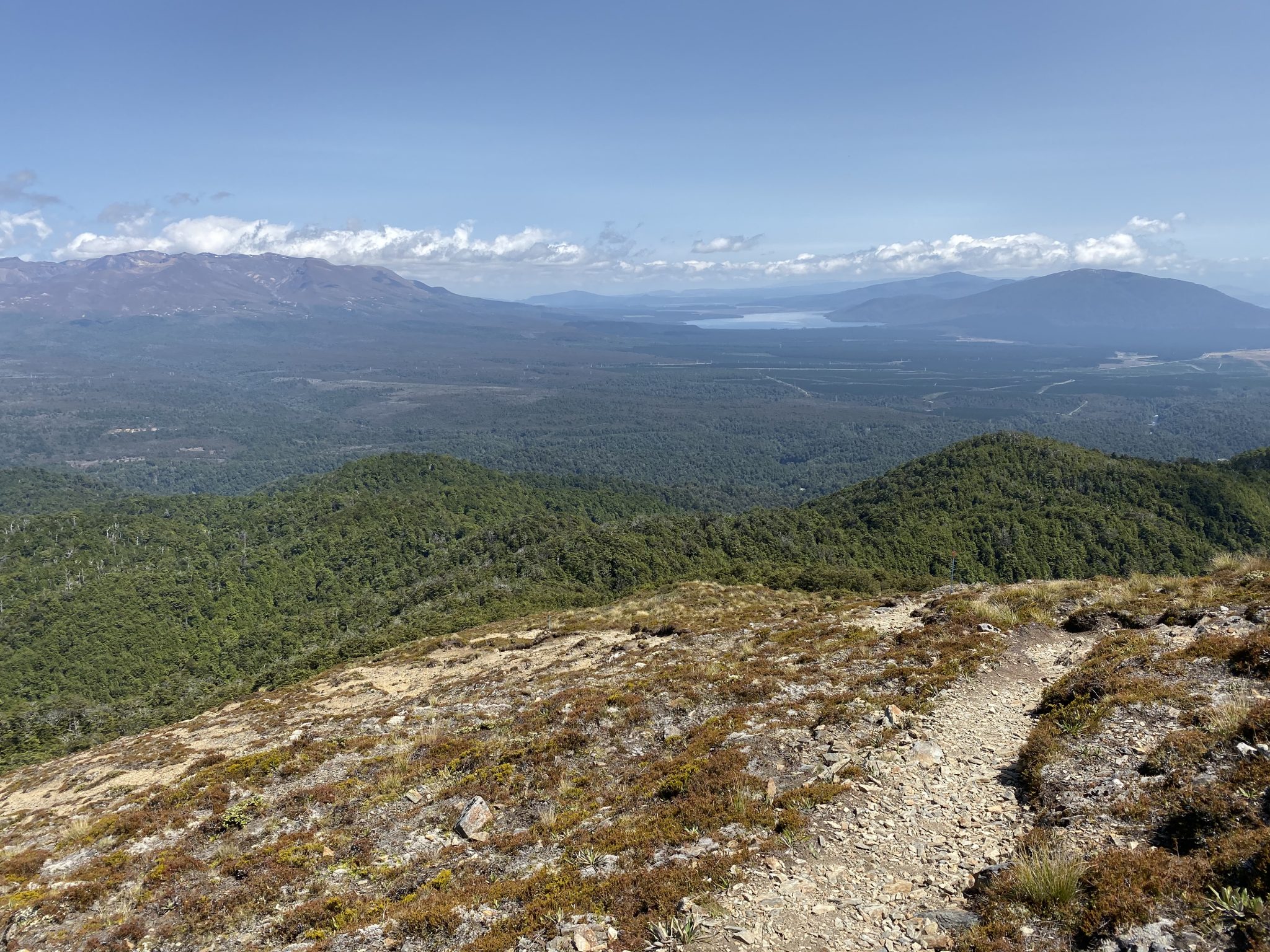
As you make your north on SH1 on the Desert Road heading to Turangi Taupo town, there is a stunning area called the Kaimanawa Forest Park which is opposite the Tongariro National Park.
Within the park, there is a seriously challenging hike that I would encourage any experienced hiker to have a go at – the Mount Urchin Track.
An out-and-back 7.4 kilometre hike, this is the beginning of a much larger hike through the wider Kaimanawa Range which is typically known for backcountry hunting.
With a total rise in elevation of almost 600 metres, and finishing at 1,397 metres, there are times when the path seems unrelenting.
At approximately the 1,300 mark is when you peak out above the tree line and the next 100 metres is a steep rocky path to the top where not only a trig awaits you, but a seriously amazing view of the Tongariro National Park.
Honestly, it’s worth the effort.
Because there are a number of other hikes in the surrounding area that get plenty more coverage than Mount Urchin, this is one of those walks that you can expect to almost have to yourself.
So if you have a good base level of fitness, are used to rocky paths & hills, and have a reasonable amount of hiking experience, then the Mount Urchin Track is definitely worth it.
Things to Remember When Hiking in The Tongariro National Park
Despite the popularity of many of the hikes in the Tongariro National Park, both featured & not featured in this adventure guide, it can be a fairly unforgiving place if you don’t take the necessary precautions before and during your adventure.
Some things to remember when hiking in the park:
- If there’s even a chance there’s going to be terrible weather, don’t head out. Whether it be rain, wind, or if it happens to snow, then don’t risk it. There have been countless incidents where people haven’t taken the advice of those more experienced i.e. park rangers and have decided to head out anyway and have either needed to be rescued or, worse, have died.
- River crossings. Depending on the time of year, you might need to cross a river or two; depending on which track you’re on. Furthermore, the depth of the river crossing will depend on the time of year too. If you’re out there and come across a swollen river, don’t attempt to cross it. It’s not worth it
- Volcanic eruptions. The Tongariro National Park is a volcanic area with three mountains that were once active volcanoes – Tongariro, Ngauruhoe, and Ruapehu. Now, while they haven’t erupted in some time (I believe Tongariro erupted last in November 2012), it doesn’t mean they won’t. Be sure to check in with park rangers and the i-Site at Whakapapa Village for volcanic warnings before you head off.
- Snow and avalanches. As it’s an alpine park, there is plenty of chances of snowfall; especially during winter. Even if you’re an experienced hiker, hiking in these conditions can make hiking times longer and more difficult than usual. It can also cause issues with visibility. In saying that, if you are keen on hiking in the snow in the park, there are a number of local, professional guides who you could engage to help.
- Water. Be sure to bring plenty with you as it’s not a smart idea to drink out of the streams regardless if you’re using a filter.
- Even though the Alpine Crossing, along with many other walks in the park, is a day hike, I’d still recommend packing the appropriate gear. Too many times have people attempted these walks and have been grossly underprepared which puts their safety, and the safety of others, at risk. Be sure to pack enough water & food, a jacket or two in case the weather turns, appropriate footwear, general warm clothing, gloves, a hat, and a map. I really can’t stress this enough. The weather in the area can turn in a second and if you’re caught up in it without the right gear, then it could be fatal.
Other things to do when visiting the Tongariro National Park Area
If you’re staying in the Tongariro area and are looking for other things to do beyond the hiking trails mentioned in this blog, check out this great guide from our friends at the Old Post Office Lodge.
In summary…
I hope you’ve thoroughly enjoyed reading our adventurer’s guide to hiking in the Tongariro National Park in New Zealand.
Essentially, my hope for this blog is to showcase some of the amazing hikes you can do in the area which includes some of the more popular hikes, but also some that you may not have heard of before.
Be sure to take this guide with you the next time you’re planning an adventure on the North Island of New Zealand.
